Washington Secondary Bike Path
States: Rhode Island
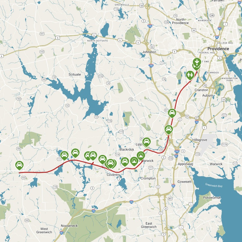
Length: 19.2 miles
Trail end points: Dead end of Depot Ave., near its intersection with Cory Ave. (Cranston RI) and Railroad St. and Log Bridge Rd. (Coventry RI)
Trail surfaces: Asphalt
Trail category: Rail-Trail
| https://www.traillink.com/trail/washington-secondary-bike-path/ |
TrailLink is a free service provided by Rails-to-Trails conservancy (a non-profit) . Along with an amazing website they have a free TrailLink app that's very helpful. And if you upgrade to their yearly unlimited plan ($29.99/year) you can also see your location "live" out on the trail as well as download unlimited offline maps. Bikebarn receives no compensation whatsoever from TrailLink - we just think they're a group worth advocating for.
Description:
The Washington Secondary Bike Path offers just over 19 miles of paved trail from Cranston (Providence’s southwestern neighbor) to Coventry. The rail-trail, Rhode Island’s longest, follows the former Hartford, Providence and Fishkill Railroad. Although sections of the trail have their own distinct local names—Cranston Bike Path, Warwick Bike Path, West Warwick Greenway, Coventry Greenway, and Trestle Trail—the overall experience is seamless. The trail is also part of the expansive and developing East Coast Greenway, which connects paths throughout New England and all the way down to Florida.
Locals will tell you that the farther west you travel on the trail, the prettier it gets; their advice rings true, so a nice place to begin your journey is in the middle and then head west for a well-shaded and scenic ride. (You could also start at the west end and ride toward the middle to enjoy a slight downhill grade.) This western half has a rural feel to it and includes a parallel bridle path.
The eastern half of the trail is more urban in flavor with residential and commercial areas pressed close alongside. This Cranston end of the trail is not as well maintained, and though it serves as a useful route for residents, tourists may not find it as appealing.
A good mid-route starting point is the trail parking lot adjacent to Horgan Elementary School in West Warwick. (Riverpoint Park, also located in this area but a touch farther from the trail, is another option.) Be sure to take a moment to check out the bright red New York, New Haven and Hartford Railroad caboose on display at the east end of the school complex; while it’s only 200 feet from the path, the sight lines are such that it can be easy to miss. Once on the path, head southwest, wending through the heart of West Warwick. From here to the west end of the trail is an 11-mile ride.
Although numerous street crossings occur along this section, each is well marked and most are across smaller secondary roads with little traffic. These crossings also provide a convenient way to step off the trail and grab a bite to eat or hit a restroom—useful options since there are few amenities along the trail itself.
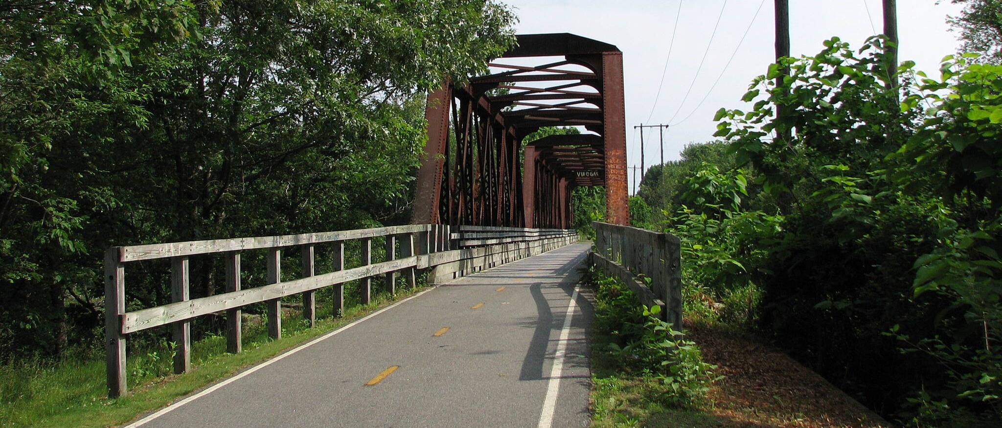
As you enter Coventry, you’ll find yourself sharing the trail with bikers, joggers, dog walkers, families with young children, and leisurely amblers—and it’s no wonder that the trail is so popular, as it’s smoothly paved and surrounded by tall trees. The nearby Pawtuxet River has a sinuous route, so you’ll cross it a couple of times on beautiful bridges with nice views.
As you traverse Coventry, look for a short section of preserved railroad track that parallels the trail; a trailhead kiosk here provides information about the trail’s history. Continuing west, you’ll have views of Flat River Reservoir, a recreational hot spot for fishing and boating. Farther on, the trail travels through fern-covered rock cuts and the tree canopy gets thicker, for a cool, pleasant ride.
At Hill Farm Road, the route pops out of the trees into a more open area with a few houses and small businesses nearby. You’ll find a large parking lot adjacent to the trail and more interpretive signage on railroad history. From here, it’s only another 3.5 miles of riding to where the trail stops unceremoniously at a wall of brush. There’s another large parking lot at trail’s end, which is helpful if you’ve coordinated a pickup, and a general store with drinks and snacks to refuel.
Trail advocates hope to one day extend the trail another 6 miles west to the Connecticut border, where a connection to the Moosup Valley State Park Trail awaits.