Cape Cod Rail Trail
States: Massachusetts
Length: 27.5 miles
Trail end points: Route 134 (South Dennis MA) and Lecount Hollow Road between Kincaid St. and US 6 (Wellfleet MA)
Trail surfaces: Asphalt
Trail category: Rail-Trail
| https://www.traillink.com/trail/cape-cod-rail-trail/ |
TrailLink is a free service provided by Rails-to-Trails conservancy (a non-profit) . Along with an amazing website they have a free TrailLink app that's very helpful. And if you upgrade to their yearly unlimited plan ($29.99/year) you can also see your location "live" out on the trail as well as download unlimited offline maps. Bikebarn receives no compensation whatsoever from TrailLink - we just think they're a group worth advocating for.
Description:
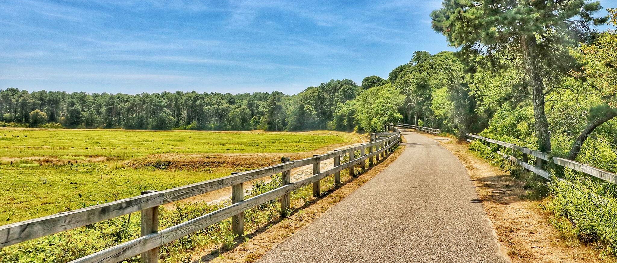
Cape Cod’s briny seaports, sandy beaches, delectable seafood, and diverse landscape of salt marshes, pine forests, and cranberry bogs can all be experienced from the 27.5-mile Cape Cod Rail Trail. Completely paved and mostly flat, the trail is a popular destination for families and recreational bicyclists.
The route follows 19th-century rail lines that carried vacationers to the once remote peninsula from Boston and New York City. Between Yarmouth and Orleans, the trail follows the Cape Cod Central Railroad, completed in 1865. The Old Colony Railroad bought the line in 1872, then extended it from Orleans to Provincetown, past the trail’s current endpoint in Wellfleet. Passenger service ceased in 1937, and freight hung on until the mid-1960s. By 1978 the trail was in place, and vacationers once again hit the corridor, but this time on foot, in-line skates, and bicycles.
The rail-trail starts at a long-awaited extension opened in 2017 in Yarmouth, where it meets a local bike trail at Peter Homer Memorial Park. (Long-range plans call for extending the trail westward to Barnstable.) Crossing Station Avenue on a pedestrian bridge, the trail rolls through woods for 2.5 miles to a 160-foot bridge over the Bass River (scheduled for opening in late 2018; signs will be posted at the trailhead regarding the bridge status), and then another pedestrian bridge over MA 134 to an old trailhead in South Dennis.
The next 3 miles offer ample opportunities to picnic, indulge in ice cream, or detour to other trails and towns. The Cape Cod Rail Trail meets the Old Colony Rail Trail at a landscaped bicycle rotary with a picnic area and information kiosks in Harwich. That alternative trail heads east 7 miles through the Hacker Wildlife Sanctuary and ends in Chatham.
Heading north from the rotary on the Cape Cod Rail Trail, you’ll soon be sailing past kettle ponds formed when glaciers melted, leaving behind pockets of freshwater enjoyed as swimming holes today. Quaint general stores provide refreshments that can be consumed on-site or at trailside picnic tables. Near mile 14 you’ll reach Nickerson State Park, which offers swimming pools, picnic areas, walking and biking trails, restrooms, and camping throughout its 1,900 acres. The 8-mile forested trail here makes for a shady, cool ride.
The path joins a small road for a short distance 1.5 miles past Nickerson, crosses a bridge, and enters the bustling tourist town of Orleans. Boasting a variety of restaurants and specialty stores, this former whaling seaport is a good place to stop for lunch, shop, or visit historical sites. About 3.5 miles past Orleans you’ll see signs to the Cape Cod National Seashore’s Salt Pond Visitor Center, located about 0.5 mile off the trail.
The remaining miles offer public campgrounds and coastal overlooks. At trail’s end, Wellfleet occupies a narrow strip of the cape, flanked by the Atlantic Ocean and Cape Cod Bay. A mile trip east on Lecount Hollow Road from the trailhead is rewarded with large dunes and a sandy ocean beach. Locally grown oysters are available in many restaurants and honored in October’s Wellfleet Oyster Fest.
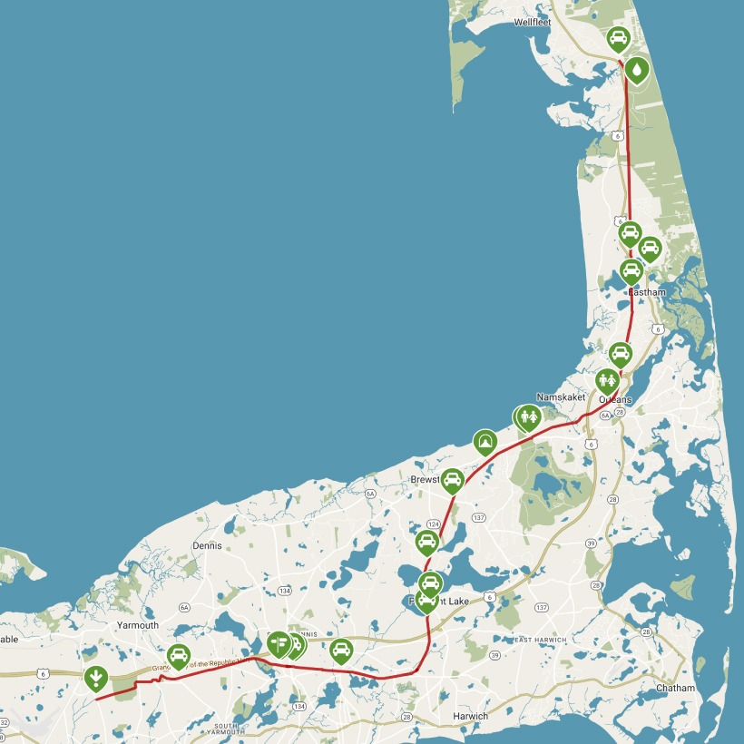
Click Map below to see interactive version