Upper Charles Trail
States: Massachusetts
Length: 13.2 miles
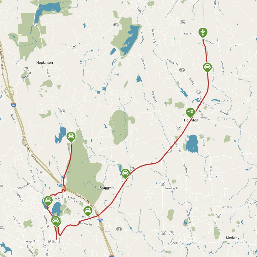
Trail end points: Whitney Street (Sherborn MA) and Cedar St./SR 85 (Milford MA)
Trail surfaces: Asphalt, Crushed Stone
Trail category: Rail-Trail
| https://www.traillink.com/trail/upper-charles-trail/ |
TrailLink is a free service provided by Rails-to-Trails conservancy (a non-profit) . Along with an amazing website they have a free TrailLink app that's very helpful. And if you upgrade to their yearly unlimited plan ($29.99/year) you can also see your location "live" out on the trail as well as download unlimited offline maps. Bikebarn receives no compensation whatsoever from TrailLink - we just think they're a group worth advocating for.
Description:
The developing Upper Charles Trail will one day total 24 miles, linking the communities of Milford, Ashland, Sherborn, Holliston, Framingham, and Hopkinton along a former railroad bed. As of 2018, more than 13 miles of the trail are complete.
A good place to begin your trail journey is Fino Field in the town of Milford, as parking and bathrooms are available here. From Milford, the trail is shaped like a "V" with both branches paved in this community for a total of 6.5 miles. The fork heading north, past Milford Pond and Louisa Lake Park, is asphalt surfaced until it hits the Hopkinton town line. Traveling this branch of the trail offers great opportunities to view wildlife in the adjacent forests and bogs. This stretch also includes several well-marked road crossings, designed for bicycle and pedestrian crossing.
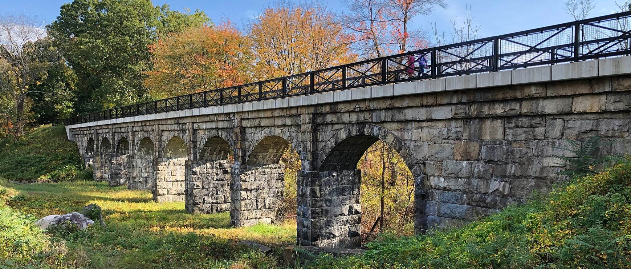
The branch heading northeast switches to a stone-dust surface at the Holliston town line, continuing for 6.7 miles to its end at the Sherborn town line. As travelers pedal through Holliston, they will encounter the historical Phipps Tunnel, constructed to allow steam trains to travel under Highland Street; the design of the tunnel, with its curved walls, is quite unique. Another highlight of this section is the Bogastow Brook Viaduct, a beautiful stone bridge with eight arches. As the trail approaches its end, you'll also traverse the scenic Dopping Brook Conservation Area. Throughout this stretch, it is clear how much the local community takes pride in the trail, from the clean and well-maintained surface to the installation of trailside art.
The trail ends on Whitney Street, with a small parking lot located at the trailhead added in 2021.