Bruce Freeman Rail Trail
States: Massachusetts
Length: 11.7 miles
Trail end points: Northwest Expressway and River Meadow Brook (Lowell MA) and South of Weatherbee St. (Acton MA)
Trail surfaces: Asphalt
Trail category: Rail-Trail
| https://www.traillink.com/trail/bruce-freeman-rail-trail/ |
TrailLink is a free service provided by Rails-to-Trails conservancy (a non-profit) . Along with an amazing website they have a free TrailLink app that's very helpful. And if you upgrade to their yearly unlimited plan ($29.99/year) you can also see your location "live" out on the trail as well as download unlimited offline maps. Bikebarn receives no compensation whatsoever from TrailLink - we just think they're a group worth advocating for.

Description:
Bruce N. Freeman was a Massachusetts state representative from 1969 to 1986. Beginning in 1985, he championed the creation of a bike path that would run along the former Penn Central railroad line from Industrial Avenue in Lowell to South Sudbury. Inspiration for the trail (then referred to as the Lowell-Sudbury Rail Trail) came partly from seeing the Cape Cod Rail Trail, as well as a bike trail in San Jose, California, on which Freeman had ridden with his son and grandson. After Freeman’s death in 1986, his successor Carol C. Cleven introduced a bill that would make the bike path a reality.
You can start your journey at the northern endpoint in Lowell. From here, a green painted path goes from the nearest building into the trail parking lot, providing great access for those who work in the buildings near the trailhead.
The trail starts with an extensive culvert tunnel under US 3/Northwest Expressway. On the other side of the tunnel, you’re greeted with flowers as the rail-trail runs along the back side of several business areas. In 0.8 mile from the trailhead, the trail runs diagonally under the large I-495/Blue Star Memorial Highway overpass as you enter the Chelmsford area. Baseball fields are just off the trail to the left as you cross Chelmsford Street in another 0.5 mile. The path begins again on the other side. Here, you’ll make your way into a little downtown area, where the trail follows Chelmsford Street very briefly.
In 0.3 mile, be careful as you cross the central intersection of MA 4/North Road and MA 110/Littleton Road, as this is located in the middle of town. Take the trail almost straight through the intersection, following signs for the safe crosswalks that will lead you to the other side. A small lantern man sculpture off to the right lets you know that you’re back on the trail. A few more pieces of art are just ahead, where an old train depot used to be.
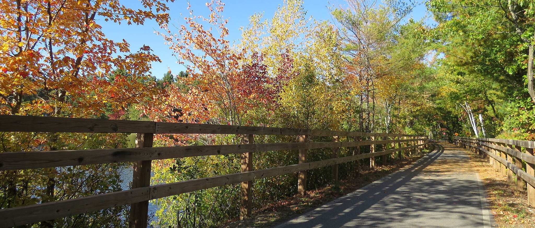
As you head out of town for the remaining 5.1 miles, you’ll pass through a rural section—much of it covered by tree canopies—following Beaver Brook as it makes its way through neighborhoods. This section of trail is leisurely and wide, with fencing along both sides in some portions. In 2.7 miles, to the right of the trail in Chelmsford, is Heart Pond. Note that the beach—which contains a playground and swimming area—is open to the public. The trail skips over the corner of Heart Pond and travels along a small dockside community. It then continues south through more wooded areas with portions of fencing along the trail, adding to the structural beauty of the corridor. In 2.4 miles from Heart Pond Beach, the trail ends rather abruptly at Westford Street, without parking or a trailhead sign of any sort. The county is currently extending the trail farther south, however, and a few people do venture along the dirt corridor walking or on mountain bikes.