Shining Sea Bikeway
States: Massachusetts
Length: 10.7 miles
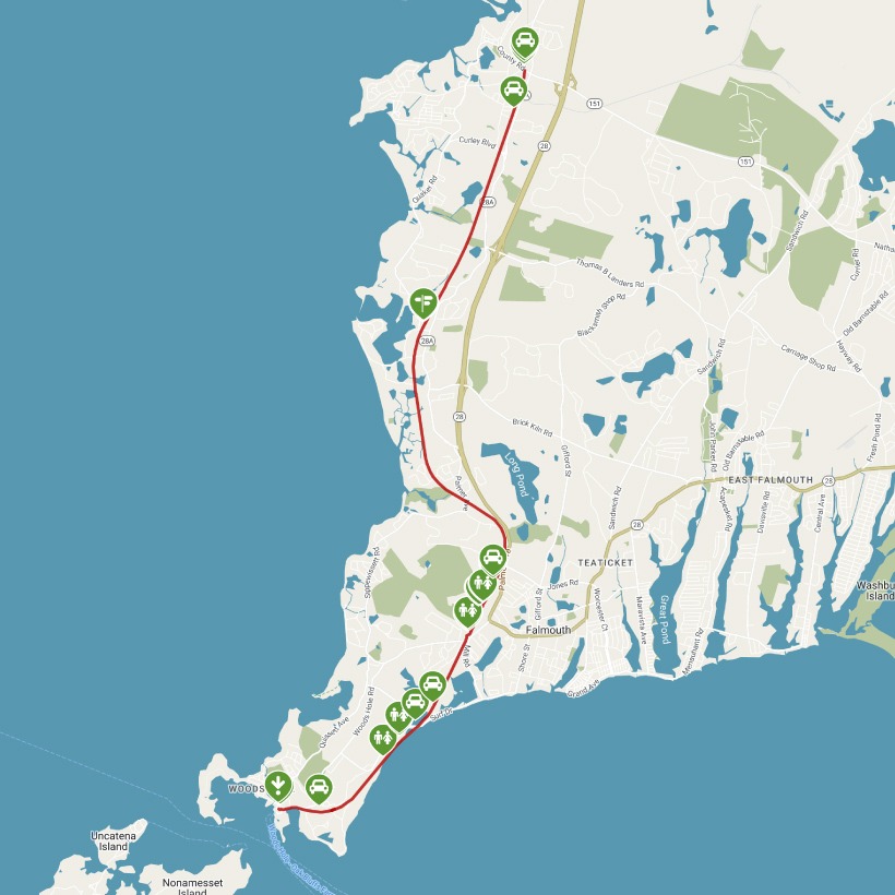
Trail end points: CR 151 (Falmouth MA) and Steamship Authority, Crane St. (Woods Hole MA)
Trail surfaces: Asphalt
Trail category: Rail-Trail
| https://www.traillink.com/trail/shining-sea-bikeway/ |
TrailLink is a free service provided by Rails-to-Trails conservancy (a non-profit) . Along with an amazing website they have a free TrailLink app that's very helpful. And if you upgrade to their yearly unlimited plan ($29.99/year) you can also see your location "live" out on the trail as well as download unlimited offline maps. Bikebarn receives no compensation whatsoever from TrailLink - we just think they're a group worth advocating for.
Description:
The Shining Sea Bikeway follows the route of a former railroad line run by the New York, New Haven and Hartford Railroad Company, which ran service to New York and Boston from 1872 to 1965. After the railroad company discontinued service along the line, local residents Joan Kanwisher, Barbara Burwell (mother of Rails-to-Trails Conservancy’s cofounder David Burwell), and several other supporters organized in a nine-year-long effort to have the village of Woods Hole acquire the land and build a trail, which officially opened in June 1974.
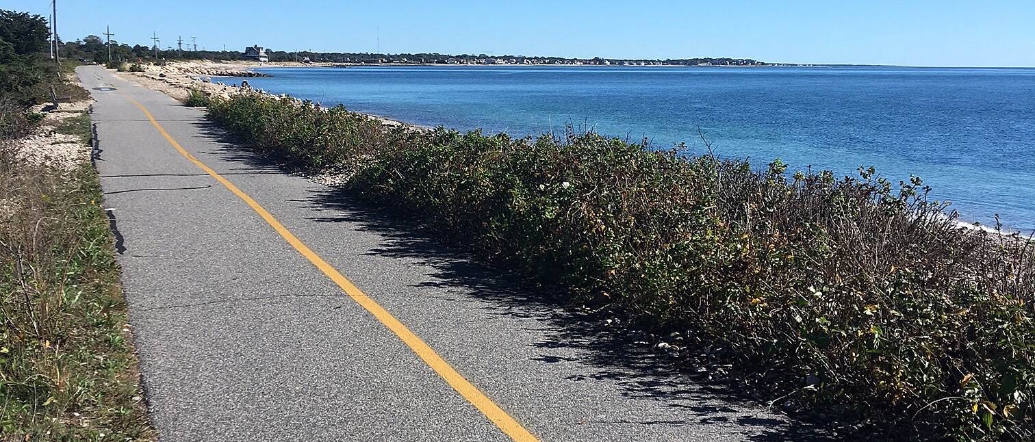
It’s no wonder that the bikeway was named after the lyrics to “America the Beautiful,” written by Falmouth native Katharine Lee Bates. The 10.7-mile Shining Sea Bikeway—the only bikeway on Cape Cod to feature a seaside section—boasts beautiful vistas of marshes, rivers, and the sea.
Although parking is available on either end of the trail, you’ll want to start your journey at the Depot Road trailhead along County Road in Falmouth, as the scenic payoff for your efforts is located at the southern endpoint in Woods Hole. Turn left out of the parking lot on Depot Road (across from Pine Street), and use the sidewalk to travel 150 feet before using the crosswalk to enter the trail on the opposite side.
Along this stretch of trail, you can see railroad ties to your left—a nod to the trail’s railroad history. After crossing Winslow Road in 0.6 mile, the path enters a wooded area and goes through an underpass decorated with bike-themed murals from the AmeriCorps Cape Cod program.
About 4 miles in, you will reach the Great Sippewissett Marsh on either side of the trail. The saltwater marsh is an important ecosystem habitat for the local flora and fauna. The Little Sippewissett Marsh is 1.3 miles farther ahead, and a connection to the Sippewissett Campground for backpackers is located on the left. The word Sippewissett, meaning “little river,” comes from the Wampanoag tribe, the original inhabitants of the area.
The trail continues through a wooded area, with trailside businesses dotting the landscape. In 2 miles, as you near Depot Avenue/Highfield Drive in Falmouth, you will find plentiful parking in multiple lots. You will then pass a bus station on your left before crossing the road to enter another trailside parking lot. The trail continues into another wooded area (Beebe Woods), occasionally intersecting streets with light traffic.
At 8.5 miles into the trail, your hard work will be rewarded with stunning vistas of the Atlantic Ocean to the left as you pass by Surf Drive Beach. This makes for a perfect stopping point to rest and admire the ocean—or even take a dip in the water, as the swimming beach is fully accessible to visitors.
After leaving the unforgettable views of the ocean, you will pass through a final wooded section that belies its suburban neighborhood with the sound of cars passing on nearby roads and houses located on the left side of the trail. As you cross a short bridge and pass through a long, linear parking lot, take care, as from here to the end you may encounter cars along your route.
After crossing the Church Street overpass toward the end of the trail, you will find Little Harbor, docked with yachts, to your left. In 0.3 mile from Church Street, continue under the Crane Street overpass to reach the end of the trail. Friends of Falmouth Bikeways—and Friends of the Bourne Rail Trail—hope one day to extend the trail north to connect to the southern end of the Cape Cod Canal Bikeway in Bourne.