Old Colony Rail Trail
States: Massachusetts
Length: 8 miles
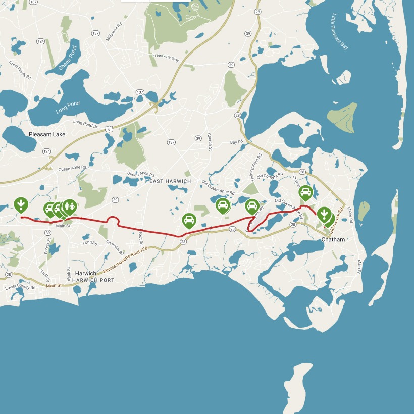
Trail end points: Cape Cod Rail Trail northeast of Main St. (Harwich MA) and Depot Rd. and Hitching Post Rd. (Chatham MA)
Trail surfaces: Asphalt
Trail category: Rail-Trail
| https://www.traillink.com/trail/old-colony-rail-trail/ |
TrailLink is a free service provided by Rails-to-Trails conservancy (a non-profit) . Along with an amazing website they have a free TrailLink app that's very helpful. And if you upgrade to their yearly unlimited plan ($29.99/year) you can also see your location "live" out on the trail as well as download unlimited offline maps. Bikebarn receives no compensation whatsoever from TrailLink - we just think they're a group worth advocating for.
Description:
The Old Colony Rail Trail, named after the eponymous railroad line that operated in Massachusetts and Rhode Island, offers a serene journey through quiet Cape Cod beach towns. At 8 miles, the trail is suitable for a short ride out and back, or a longer journey that meets up with the Cape Cod Rail Trail as it extends west.
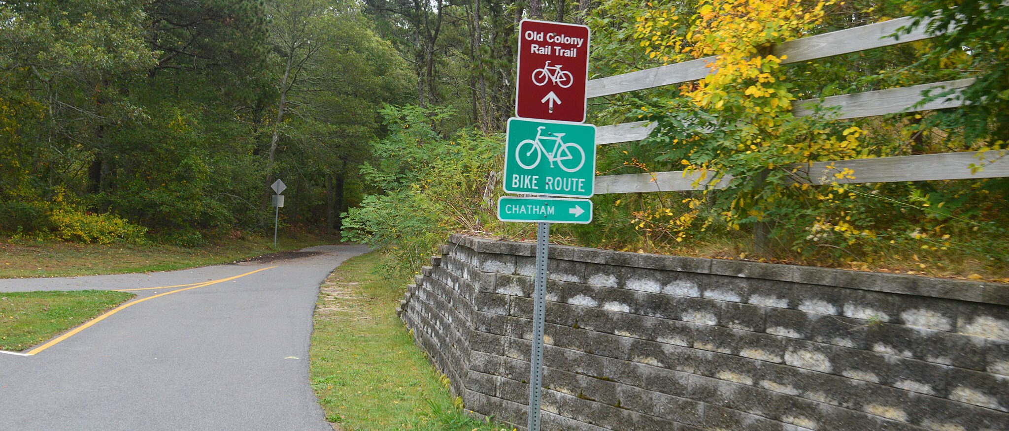
You’ll want to begin your journey at the intersection of Depot Road and Hitching Post Road in Chatham, as the western endpoint in Harwich merges seamlessly with the Cape Cod Rail Trail, making it inaccessible by car. The beginning of the trail features an on-road portion, but as it travels along quiet, residential streets, even inexperienced cyclists should feel safe. Follow Hitching Post Road 0.2 mile, then turn left onto Tip Cart Drive. Cross Crowell Road in another 0.2 mile and turn right to pick up the trail. Signage points the way at this junction.
You will pass through a short wooded area, emerging to cross Stepping Stones Road in 0.4 mile, where athletic facilities of Monomoy Regional Middle School are visible from the trail. In 0.3 mile, cross Old Queen Anne Road, and continue down Wilfred Road 0.6 mile via the on-street portion of the trail. Inexperienced cyclists should again face few difficulties, as this is a quiet neighborhood street with scarcely any vehicle traffic.
In 0.7 mile, the trail continues past the end of Wilfred Road, looping around Chatham Municipal Airport before pausing at George Ryder Road. Although the shoulder of this busy road functions as an on-road bicycle lane, inexperienced cyclists may wish to first dismount and then use the sidewalk as it appears. This section offers a unique view of personal, small aircraft parked at the airport, located on the right side of the sidewalk. At the next crosswalk (appearing after Northwood Road to the left), follow the signs and cross the street to pick up the trail again. Although it crosses several streets along the way, the remaining 5.4 miles of the trail remain off-road.
This section of the trail meanders through wooded backyard areas that dampen noise of the outside world. Save for the street crossings, it is easy to enjoy a quiet morning in nature, removed from the hustle and bustle of life. In 3 miles from George Ryder Road, you will pass a half-roundabout and continue along the path, passing Brooks Park and the Harwich Town Clerk on the next block, both located on the left. After crossing Pleasant Lake Avenue—1.2 miles from the half-roundabout—the trail passes Island Pond Cemetery on the right. Signage marks a cut-through to visit the Island Pond Conservation Lands, perfect for walking and hiking. The trail ends at the next roundabout and connects with the Cape Cod Rail Trail, which continues both west and north.