Province Lands Bike Trail
States: Massachusetts
Length: 7.7 miles
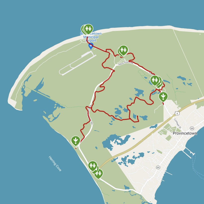
Trail end points: Herring Cove Beach on Province Lands Rd. and Race Point Rd. (Provincetown MA)
Trail surfaces: Asphalt
Trail category: Greenway/Non-RT
| https://www.traillink.com/trail/province-lands-bike-trail/ |
TrailLink is a free service provided by Rails-to-Trails conservancy (a non-profit) . Along with an amazing website they have a free TrailLink app that's very helpful. And if you upgrade to their yearly unlimited plan ($29.99/year) you can also see your location "live" out on the trail as well as download unlimited offline maps. Bikebarn receives no compensation whatsoever from TrailLink - we just think they're a group worth advocating for.
Description:
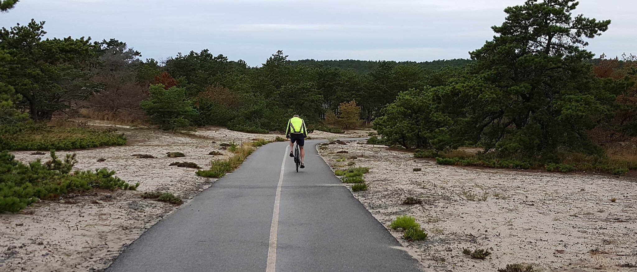
Constructed in 1967, the Province Lands Bike Trail is the first bike trail ever built by the National Park Service. The trail, located at the northern tip of Cape Cod, features steep hills, sharp turns, and some washed-out areas, depending on the time of year. Inexperienced cyclists will want to walk their bikes in some of the steeper areas, but for those who want to enjoy nature via bike ride, the Province Lands Bike Trail is the perfect place to be. The main portion of the trail creates a loop around Beech Forest, with spurs leading to Race Point Beach, Herring Cove Beach, and a nature walking trail in Beech Forest.
Starting from the Province Lands Visitor Center, you’ll want to turn left onto the trail and go almost 1 mile to Race Point Beach, as perhaps one of the steepest portions of the trail is located to the right. Ups and downs are still present in this part of the trail, and scenic sand dunes point the way to Race Point Beach. The beach is worth a visit, as it also features the Old Harbor Life-Saving Station Museum, open daily 2–4 p.m. There, you may even catch a lively group of reenactors demonstrating how the U.S. Life-Saving Service carried out operations in the late 1800s.
At the Race Point Beach spur, continue onto the main loop of the trail toward Herring Cove Beach. After passing the Provincetown Municipal Airport in less than 0.25 mile to the right, the path crosses the road at a well-marked signal crossing in another 0.7 mile. The trail then continues to parallel Province Lands Road for 2.1 miles to Herring Cove Beach, crossing under the road through several low-hanging tunnels. The scenery in this section boasts sand dunes, oak trees, brush, and a wide view of the ocean on the right.
In 1 mile after crossing Province Lands Road, turn right to pass through a tunnel under the road and continue along the spur to its end at Herring Cove Beach. The route is well marked with maps and signage to help point the way. At Herring Cove Beach, you can find a seasonal concession stand, outdoor showers, and restrooms.
Continuing 1 mile from Herring Cove Beach back to the tunnel, take a right onto the main loop, heading toward Bennett Pond. Here, sandy dunes give way to pine forests in a quiet setting away from the road, with no noise from cars. In 0.8 mile from the tunnel, turn right at a short, 0.25-mile spur to reach Bennett Pond. Back on the main loop, trail users can see cranberry bogs and a lush landscape dotted with pine, birch, oak, and maple trees.
Head north on the main loop 1.2 miles to the Beech Forest parking lot and picnic area, where you’ll find views of Blackwater Pond. Here, the Beech Forest Trail offers opportunities for bird-watching (note that bicycles are strictly prohibited on the soft-surface, walking-only trail).
Cross Race Point Road at another well-marked crosswalk to continue along the last 1.3-mile stretch of trail, which features a challenging up-and-down hilly section. End your journey back at the Province Lands Visitor Center, where you can read about the history and natural environment of the area—and get a glimpse of it in the observatory. History buffs might also want to explore Provincetown’s Pilgrim Monument, 2 miles south of the visitor center. Its 252-foot-tall granite tower commemorates the landing of the Mayflower in 1620.