Blackstone River Greenway / Rhode Island section
States: Rhode Island
Length: 19.5 miles
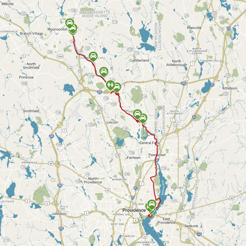
Trail end points: Rivers Edge Parking Area on the western bank of the Blackstone River (Woonsocket RI) and Tockwotton Park (Providence RI)
Trail surfaces: Asphalt, Boardwalk, Crushed Stone, Dirt
Trail category: Rail-Trail
| https://www.traillink.com/trail/blackstone-river-greenway/ |
TrailLink is a free service provided by Rails-to-Trails conservancy (a non-profit) . Along with an amazing website they have a free TrailLink app that's very helpful. And if you upgrade to their yearly unlimited plan ($29.99/year) you can also see your location "live" out on the trail as well as download unlimited offline maps. Bikebarn receives no compensation whatsoever from TrailLink - we just think they're a group worth advocating for.
Description:
The Blackstone River Bikeway in Rhode Island spans 19.5 miles, including some on-road riding. The city of Woonsocket has constructed a segment of bikeway from the Massachusetts state line into the city's Cold Spring Park, with another currently disconnected segment heading northeast along the river out from Market Square. The main segment of paved trail begins at the Rivers Edge Parking Area on the western bank of the Blackstone River in Woonsocket. From the trailhead, you’ll travel south through the heart of the river’s industrial past.
The trail is fairly wide with excellent wayfinding signage. After briefly following along a park access road, the trail crosses the road and continues through the Rivers Edge Recreation Complex, where you’ll have access to putting greens, a playground, restroom facilities, and multiple sports fields. Traveling out of the park, the trail parallels an active rail line as you make your way south, leaving Woonsocket behind and entering the community of Manville. There are multiple places to stop along the way to take in the beauty of the river and read interpretive signage about the trail’s history.
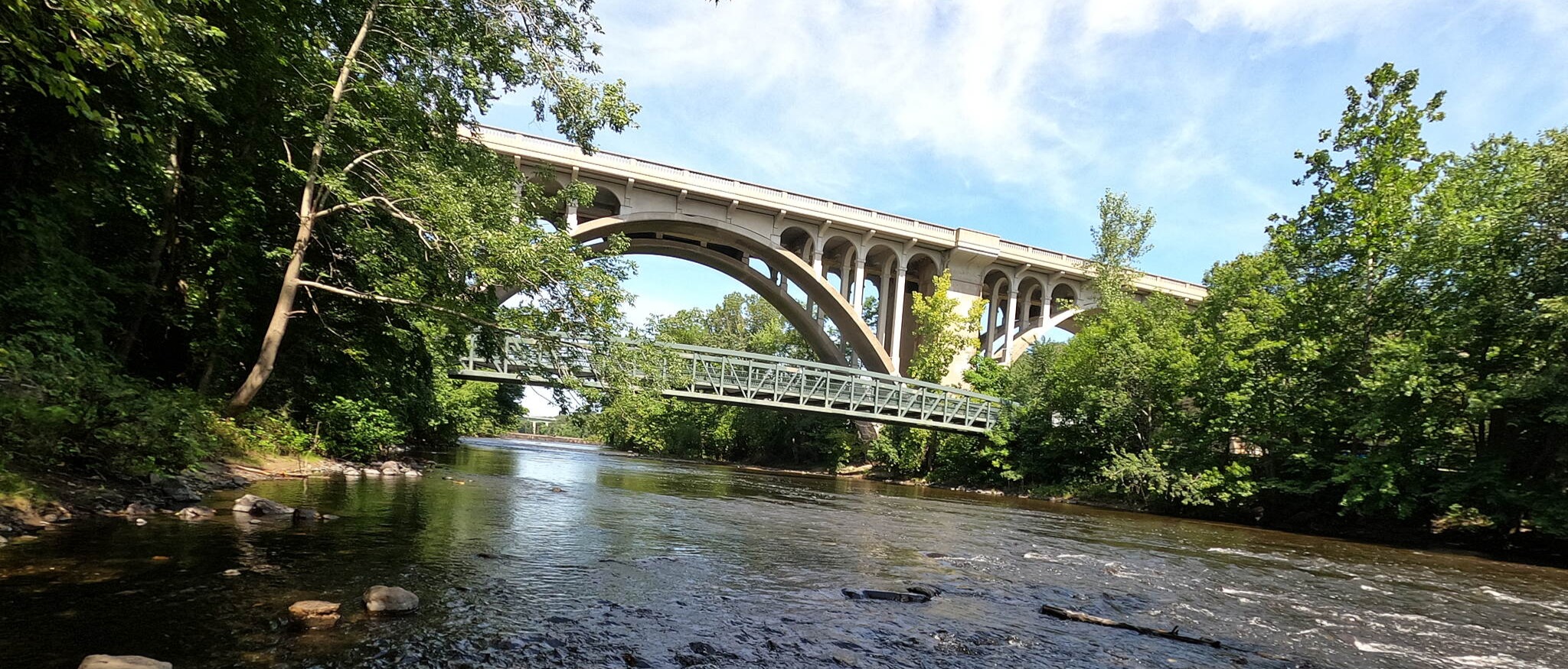
Eventually, the rail-with-trail crosses the Blackstone River, allowing for an unusual view of this side-by-side configuration of trail and rail over the water. Now on the other side of the river, the trail snakes down and under I-295, which surrounds Providence. The path crosses over the Blackstone River at the impressive Ashton Mill. Once producing cotton fabrics, this vast industrial complex has been converted into riverside apartments and lofts. The Ashton Mill and its surrounding homes were one of four mill villages that lined the river in this area—built and owned by the Lonsdale Company in the 19th century. Here, you’ll also pass the Captain Wilbur Kelly House Museum. Housed in the historical residence of a canal boat captain, the museum displays the history of transportation along the Blackstone River and canal, from prehistory through the Industrial Revolution.
You can roll or stroll along portions of the crushed-stone canalway that intersect the paved rail-trail. A branch of the trail also heads north to the large Blackstone Valley Visitor Center, off I-295. In addition to drinking water and restrooms, the center has a gift shop, a gallery, and exhibits about the Blackstone Valley river corridor. Don’t miss the vast terrazzo floor map of the valley, complete with the Blackstone River Greenway.
Head south of the Kelly House Museum on the main trail and you’ll pass under the Martin Street bridge, with its striking timber bowstring trusses. After 1.5 miles, you’ll arrive in Lonsdale, one of the mill villages along the banks of the Blackstone River. To the east, you’ll find a short pathway to parking near Lonsdale Mill. Cross over the churning Pratt Dam on an impressive bridge that uses the original stone piers from the trail’s railway past. About a mile away, you’ll come to another parking area—this one is marked with a restored drive-in theater sign, featuring the Blackstone River Bikeway and habitat restoration on its marquis. The trail meanders through secluded marshland over a boardwalk bridge, where it comes to an end at Jones Street.
Signs continue for a section of on-street bikeway to reach the Valley Falls Heritage Park in Pawtucket. You can continue on-road to just under the I-95 overpass on Taft Street, where spacious bike lanes and sharrows (symbols indicating a shared bike-vehicle lane) lead the way. Take a right onto Bowles Street, then a left onto Pleasant Street. You’ll veer right onto Alfred Stone Road and cross Blackstone Boulevard onto a tree-lined pathway for about 1.6 miles. Turn left onto Irving Avenue, then right onto River Road for a pleasant ride along the banks of the Seekonk River to the end of your journey. In India Point Park, you can pick up the East Bay Bike Path, which heads southeast for just over 14 miles to Bristol.
More info:
https://blackstoneheritagecorridor.org/exploring-the-blackstone-river-valley/maps-tours-guides/blackstone-river-bikeway/
https://www.dot.ri.gov/travel/BikeRI/blackstone.php